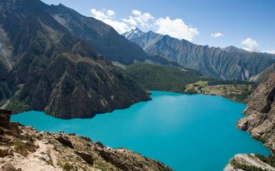
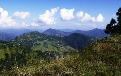
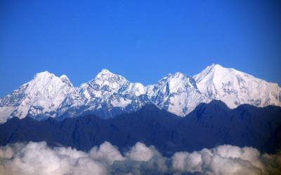
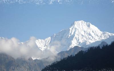
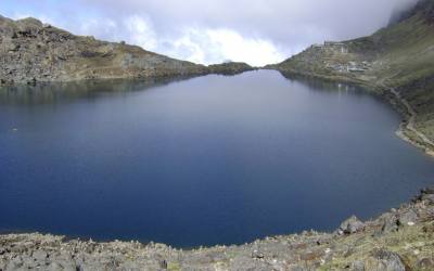
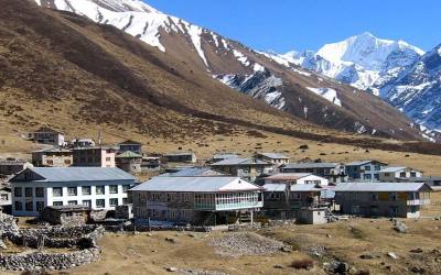
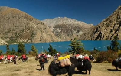
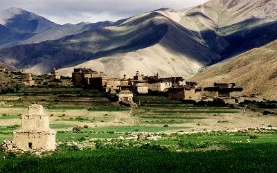
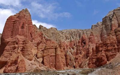
Around Dhaulagiri is one of the long and difficult trek in Nepal and it is sixth highest mountain in the world. Very few trekkers visited in this area for good reason because of the deep valleys and encircling the giant mountain. embrace a wide range of peoples and terrains, from subtropical jungle to a geographic extension of high, dry , Tibetan Plateau. The scenery is superb mix of lush vegetation, mountain peaks and an endlessly changing procession of people.
The trek start at Beni of Myagdi district. Myagdi is one of the most easterly of the districts where the Mager people can be found. This group of hill dwellers are similar in many ways to their Gurung neighbours but are thought to have settled in Nepal some time earlier.
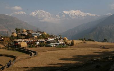
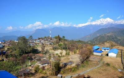
The Dhaulagiri trail follows the Myagdi khola, the river that drains the southern side of the Dhaulagiri massif. Passing through the settlements of Darbang and Muri, the country is still quite heavily populated with scattered villages and farming land. Beyond Muri , the river swings north and the landscape becomes much more rugged and sparsely populated. The tree line is reached just below the site of the, so-called , Italian base camp . located at snout of the Chhonbaraan glacier, is an ideal place to spend an acclimatization day exploring the hills around about.
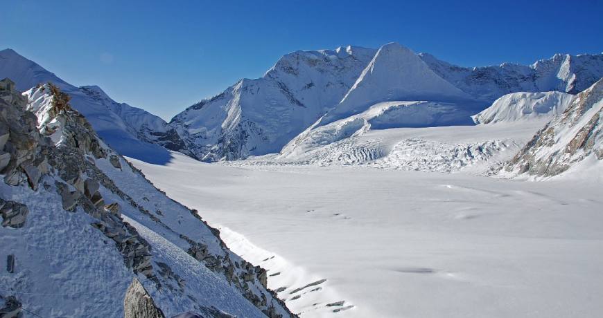
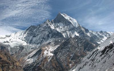
The next two days are spent on the glacier, the second nights being at Dhaulagiri base camp, a rugged spot with some spectacular views of the western face of Dhaulagiri.
Trail crosses French pass (5360m). which is the highest point of trek. Descending from French pass you will enter to the Hidden valley. The place is one of the true wilderness areas accessible to trekkers in Nepal.
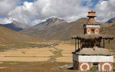
From Hidden valley the trail crosses Dampus pass(Thapa pass) which is 100m lower than French pass. After crossing Dhampus pass the trail descends in to the valley of Kali Gandaki meeting the main trail at Marpha or Tukuche. Along the way there are spectacular views across to the Annapurnas and up into the arid steppes of Mustang.
Flora and Fauna
The range of geographical and climatic regions has led to a diverse variety of flora and fauna with in this region. These parts of area are heavily cultivated and the landscape is terraced paddy fields for most of the year. the higher up in the hills the natural vegetation changes from the tropical species to more temperate stands of forest trees including oak, beech and rhododendron.
People and culture
The most prominent ethnic groups in this region are the Gurung, Braman, chetri, Thakali and the Magar.
A circuit of Dhaulagiri massif is possible for well-equipped and fully self-sufficient parties. The minimum time that should be allowed for this itinerary is eighteen days Pokhara to Pokhara but a few extra days to allow for side trips or bad weather are advisable. The route crosses two high which are in remote country far from any assistance. Particular care must be taken with regards to proper acclimatization and staff equipment. Since much of the first half of the trek travels on rarely trekked trails, the services of an experienced local guide are highly recommended. No special permits are required for the Dhaulagiri circuit but for the last part, down the kali Gandaki, an ACAP entry permit is needed.
The trek is best started at Beni, the district headquarters of Myagdi district. Myagdi is one of the most easterly of the districts where the Magar people can be found. This group of
hill dwellers are similar in many ways to their Gurung neighbors but are thought to have settled in Nepal some time earlier. Like their Gurung cousins, the Magar have a tradition of service in the Gurkha regiments. Regular bus services operate from Pokhara as far as Baglung and from there, are less frequent services to Beni.
The Dhaulagiri trail follows the Myagdi khola, the river that drains the southern side of the Dhaulagiri massif. Passing through the settlements of Darbang and Muri, the country is still quite heavily populated with scattered villages and farming land. Beyond Muri, the Myagdi khola swings north and the landscape becomes much more rugged and sparsely populated. The tree line is reached just below the sit of the, so called, Italian base camp, located at the snout of the Chhonbaraan Glacier, is an ideal place to spend an acclimatization day exploring the hills around about.
The next two days are spent on the glacier, the second night being at Dhaulagiri base camp, a rugged spot with some spectacular views of the western face of Dhaulagiri.
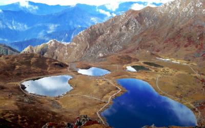
From here the trial crosses French pass which at 5360 meters is the highest point of the trek. Descending French pass you enter the lonely but fascinating area known as Hidden valley. This place is one of the few true wilderness areas accessible to trekkers in Nepal. The valley stretches away to the north eventually narrowing to a rugged gorge that connects to Upper Dolpa. There are reports of many endangered species residing in this area including the elusive snow leopard. If all the members and the staff of the group are fit then a rest and exploration day spent in hidden valley is well worth while.
From Hidden valley the trial now crosses Dhampus pass (sometimes known as Thapa pass). While not as high as French pass, it is roughly 100 meters lower, Dhampus pass has a reputation for bad weather which can make the crossing and subsequent descent something of a problem. Trekkers must be aware of the health of their group members and staff, especially on the section between French pass and Dhampus pass. Any person suffering from the symptoms of AMS must never be taken on over French pass but rather, taken back down the Myagdi khola to a lower altitude. Having a group member suffer from AMS between the passes poses a serious problem as the only way to get the patient assistance is to ascend which would make the problem worse.
Having crossed Dhampus pass the trial descends into the valley of the kali Gandaki meeting the main trial at either Marpha or Tukuche. On the way down to the valley there are some spectacular views across to the Annapurnas and up into the arid steppes of Mustang.
Day 01:Arrival and transfer to hotel in Kathmandu.
Day 02:Free day in Kathmandu or self visiting around kathmandu valley, arrange permits
Day 03:Early in the morning take a private bus journey to Beni (830m) 8 hrs of driving. Over night at the guest house
Day 04: Beni to Darbang(1110m) by sharing jeep. The drive will take 3 hrs. then trek to Dharapani(1560m) 3 hrs of Walking . over night at tent .
Day 05: Dharapani to Muri (1720m) 6 hrs of walking. Over night at tent
Day 06 : Muri to Bogohara (2080m) 7-8 hrs of walking. Over night at tent
Day 07 : Bogohara to Dhoban Khraka (2520m) 6-7 hrs of walking. Over night at tent
Day 08: Dhoban kharka to sallaghari (2900m) 5-6 hrs of walking . over night at tent
Day 09 :Sallaghari to Italian base camp (3730m) 3-4 hrs of walking. Over night at tent
Day 10 :acclimatization day and explore around
Day 11:Italian base camp to Swiss base camp(3870m) to- Japanese base camp (3890m) 6-7 hrs of walking . over night at tent
Day 12 :Japanese base camp to Dhaulagiri base camp(4748m) 4-5 hrs of walking. Over night at tent.
Day 13 :Dhaulagiri base camp rest day and explore around
Day 14:Dhaulagiri base camp to French Pass to Hidden valley (5140m) 8-9 hrs of walking. Over night at tent.
Day 15 : Hidden valley to Yak kharka (4930m) 6-7 hrs of walking. Over night at tent.
Day 16 :Yak kharka to Marpha 2670m) by trek. 6 hrs of walking than by local sharing jeep to Jomsom (2720m) The drive will take half an hour. or walking down to Tukuche then by sharing jeep to Tatopani. The drive will take 4-5 hrs.
Day 17 :Jomsom to Pokhara by air or by jeep or by bus to pokhara. By flight it takes 20 minutes . if you intend to drive back then it will takes 7 hrs of driving.
Day 18 : Free day in Pokhara or self visiting around pokhara valley
Day 19 :By tourist bus back to kathmandu. The bus journey will take 7-8 hour
Day 20 : Free day in Kathmandu or self visiting around kathmandu valley.
Day21 : Tour Ends ( departure for onwards destination)
Day 01: Arrival and transfer to hotel in Kathmandu.
Upon arrival in Kathmandu. Our airport representative will be waiting outside the airport terminal a few metres from the exit door. Please check your name at play card. He will bring you to hotel in kathmandu. The drive from the airport to the hotel is around 20 minutes.
Day 02: Free day in Kathmandu or self visiting around valley (option are)
Hanumandhoka ( Kathamdnu Durbar Square ):
It is the historic seat of royalty. The Durbar Square , with its old temples and palaces, epitomizes the religious and cultural life of people. It is here that kings of Nepal are crowned and their coronations solemnized. Interesting things to see here are, Taleju temple built by king Mahendra Malla in 1954 AD, the temple of Kal Bhairab , the god of destruction, Nautale durbar, the statue of King Pratap Malla, the big drum and the Jaganath temple. It was listed in the UNESCO world heritage monument list in 1979.
On the right hand corner, a large wooden lattice screen hides an enormous gilded face of Sweta Bhairab. The screen is removed only during the Indra Jatra festival.. there are also the Numismatic museum and Tribhuban museum inside the Hanuman Dhoka palace building . Photography is prohibited inside the museums. Both the mseums remain closed on Tuesday and government holidays.
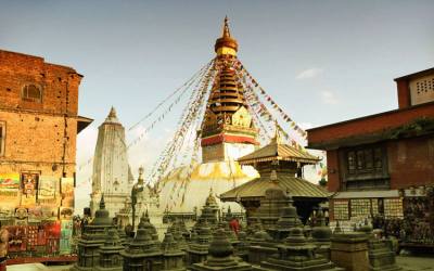
Swoyambhunath ( Monkey temple)
This is one of the world’s most glorious Buddhist Chaityas. It is said to be 2,000 years old. Painted on the four sides of the spire’s base are the all seeing eyes of Lord Budhha. It is 3Km west of Kathmandu city and it situated on a hillock about 77 m commands an excellent view of the Valley. This stupa is the oldest of its kind in Nepal . It was listed in the UNSCO world Heritage Monument List in 1979.
Day 03: Early in the morning take a local bus journey to Beni (830m)
The bus drive will take 9-10 hour
Day 04: Beni to Darbang (1110m) by local sharing Jeep
Trail follows the Myagdi Khola . along the way there is a popular hot spring. Trail passes through villages and rice paddies.
Day 05: Darbang to Dharapani (1560m)
Trail continues bank of Myagdi khola till phedi. After lunch trail goes uphill for two hours in pine forest to reach Dharapani and it is one of the biggest village in surroundings.
Day 06: Dharapani to Muri(1720m)
After crossing the river to its West Bank as you leave Phedi the trail starts climbing in earnest and there will be many switch-backs until you arrive at the ridge and the angle of ascent eases. Again the trail climbs steeply to the villages of Muri. Continue your trek to Sibang and Mattim. From here you continue up an incline to the snout of a ridge, descend to the Gatti Khola and reach Phalai Gaon (1,810 meters). Cross the Dhara Khola to once again emerge on the west bank of the Myagdi Khola and then climb a ridge to the large Magar village of Muri.
Day 07: Muri to Bogohara (2080m)
Descend a little, cross a stream and continue through terraced fields before climbing a ridge to reach the pass from where you can see Mt. Ghustung South (6,465 meters). Descend to the Myagdi Khola and trek along its West Bank to the village of Naura from where you will climb a little before traversing a grassy hill and climbing a steep slope with switch-backs and then descend through a forest and terraced fields to Boghara (2,080 meters). Overnight at tented camp.
Day 08: Bogohara to Dhoban Kharka (2520m)
The trail first descends through terraced fields to a small ridge and then through a forest to Jyardan which is the most remote permanent settlement in these parts. After the settlement a high winding path crosses a rocky area and then descends before climbing again to Lipshe where there is on single hut. The trail continues through a forest to Lapche Kharka and then climbs to the level area at Dobang.
Day 09: Bagohara kharka to Salla Ghari (2900m)
After crossing a wooden bridge out of Dobang the trail ascends a forested area. Soon the west face of Dhaulagiri I (8,167 meters) becomes visible through breaks in the trees. Descend to the Myagdi Khola and cross it via a wooden bridge to the east bank continue to Chartare. Passing through forests again, you cut across a rocky area and cross a stream to Choriban Khola.
Day 10: Sallaghari to Italian base camp (3730m)
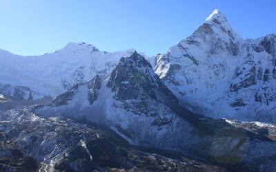
Follow a trail to the terminal moraine of the Chhonbarban Glacier and enter the glacier from the right. Tukche Peak (6837 meters) becomes visible straight on; at the far end while the impressive north flank of Dhaulagiri I (8,167 meters) dominates the skyline to your right. After a short while you will reach Italian Base Camp (3,660 meters), which is also the site of your camp for the night. To the west are the peaks of Dhaulagiri II (7,751 meters), Dhaulagiri III (7,715 meters) and Dhaulagiri V (7,618 meters).
Day 11: Acclimatization day and Explore around
Day 12: Italian base camp to Swiss base camp (3870m)
Set up early in the morning when the weather is expected to be clear. Trail is bit prone to stone fall, and pass through a narrow gorge. Today we stay overnight near at glacier.
Day 13: Swiss base camp to Japanese base camp ( 3890m)
Trail passes through narrow path
Day 14: Japanese base camp to Dhaulagiri base camp (4748m)
This is one of our adventurous days to Dhaulagiri base camp. From here you can look up at the impressive north face of Dhaulagiri I (8167 meters) dominates the skyline to your right. To the west are the peaks of Dhaulagiri II (7,751 meters), Dhaulagiri III (7,715 meters) and Dhaulagiri V (7,618 meters). In front of you is the impressive ice fall that descends from the north east col.
Day 15: Dhaulagiri base camp to Hidden valley (5140m)
After the glacier you climb two terraced hills, the first of which runs along the glacier, and then cutting across a mountain flank and a moraine you enter a gentle incline on the left from an ablation valley. Climb this gentle slope to the French Pass(5,360 meters). A great vista opens up from the French Pass and you will be able to see Mukut Himal (6,328 meters), Tashi Kang (6,386 meters) and Sita Chuchura (6,611 meters), all of which surround the Hidden Valley. To the south is TukchePeak (6,920 meters) and beyond is the massive peak of Dhaulagiri I. From FrenchPass you continue along the right edge of the Hidden valley losing a little altitude to Thapa Pass (5,250 meters) between Tukche Peak and Thapa Peak (6,012 meters). Descending from Thapa Pass you will make a camp at about 5,200 meters.
Day 16: Hidden valley to Yak Kharka (4930m)
Descend from the hidden valley, to the Dhampus Pass and continue to Yak Kharka. There is a perfect camp site to enjoy the surrounding. Overnight at tented camp.
Day 17: Yak Kharka to Marpha than to Jomsom (2720m)
Descend to the village of Marpha, on the west bank of the Kali Gandaki River. Marpha is home to many apple orchids as well as all the various food products made from the fruit. Apple Brandy is a local specialty that you may be lucky enough to taste en route. Continue to north, up the river valley to the town of Jomsom. Overnight at tented camp.
Day18: Jomsom to Pokhara by air
Take a early flight to Pokhara and flight will take about 20minates.
Pokhara is set in a lovely valley at the foot of the Machapuchare so you get spectacular views of the mountains from all parts of the town. It is quite different from Kathmandu, with few temples, but it does have plenty of scenic attractions and is close to the mountains. There are some interesting short walks or bicycle rides from Pokhara, you can swim and canoe on Lake Phewa or just watch the last rays of the sun stream across the dip in the mountains that hold the lake. Along the lakeside road there is a continuous
stretch of small hotels, restaurants and shops; it’s an area which still has a bit of the old hippy scene feel about it.
Day 19: Free day in Pokhara or at the afternoon paragliding tour from Sarangkot
Pokhara is a remarkable place of natural beauty. Situated at an altitude of 827m from the sea level and 200km west of Kathmandu valley, the city is known as a center of adventure with several beautiful lakes and offers stunning panaromic views of Himalayan peaks.
The serenity of lakes and the magnificence of the Himalayas rising behind them create an ambience of peace and magic. So today the city has not only become the starting point for most popular trekking and rafting destinations but also a place to relax and enjoy the beauty of nature.
Pokhara is part of a once vibrant trade route extending between India and Tibet. To this day, mule trains can be seen camped on the outskirts of the town, bringing goods to trade from remote regions of the Himalaya. This is the land of Magars and Gurungs, hardworking farmers and valorous warriors who have earned worldwide fame as Gurkha soldiers. The Thakalis, another important ethnic group here, are known for their entrepreneurship.
The climate of Pokhara is slightly warmer than Kathmandu with daytime temperature hovering around 15 degrees Celsius in winter and 35 degrees in summer. The monsoon season which lasts from mid-June to mid-September is very wet; in fact Pokhara records the highest rainfall in the country. Best time to visit is between October and April.
The activities of foreign visitors to Pokhara focus around two districts known as Damside and Lakeside (or Pardi and Baidam, in Nepali, respectively). These two areas, with their strips of hotels and restaurants, are a few kilometers south-west of the main Pokhara bazaar. More
Sarangkot
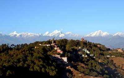
The view of the Annapurna Himalaya from Sarangkot is almost a religious experience. From here, you can see a panoramic sweep of Himalayan peaks, from Dhaulagiri (8167m) in the west to the perfect pyramid that is Machhapuchhare (6997m) and the rounded peak of Annapurna II (7937m) in the east. Most people come here at dawn or dusk, when the sun picks out the peaks in brilliant colours.
Fewa lake
Fewa Lake, the second largest lake in the Kingdom, is the center of attraction in Pokhara. It is the largest and most enchanting of the three lakes that add to the resplendence of Pokhara.
Mahendra cave
Another of nature’s wonders in Pokhara is the Mahendra Gupha. This large limestone cave is locally known as the House of Bats, an apt name for it. A two-hour walk to the north of Pokhara, it is best to bring your own torch to see the stalactites and stalagmites, as well as the local winged residents.
Seti River
Another of Pokhara’s natural wonders that unfailingly interests visitors is the Seti river. Flowing right through the city, this river runs completely underground at places. Amazingly, at certain points the river appears hardly two meters wide. But its depth is over 20 meters! Mahendra Pul, a small bridge near the old MissionHospital, provides a perfect view of the rivers’s dreadful rush and the deep gorge made by its powerful flow.
Barahi Temple
The Barahi temple is the most important monument in Pokhara. Built almost in the center of Phewa Lake, this two-storied pagoda is dedicated to the boar manifestation of Ajima, the protectress deity representing the female force Shakti. Devotees can be seen, especially on Saturdays, carrying male animals and fowl across the lake to be sacrificed to the deity.
Museum
The Pokhara Museum, located between the bus stop and Mahendra Pul, reflects the ethnic mosaic of western Nepal. The lifestyles and history of ethnic groups such as the Gurung, Thakali and the Tharu are attractively displayed through models, photographs and artifacts. One major attraction is a display highlighting the newly-discovered remains of an 8000-year-old settlement in Mustang.
Open daily, except Tuesdays and holidays, from 10 am to 5 pm
Devi’s Fall
Locally known as the Patale Chhango (Hell’s Fall). Devi’s Fall (also known as Devin’s and David’s) is a lovely waterfall lying about two km south-west of the Pokhara airport on the Siddhartha Highway. Legend has it that a trekker (Devin, David..) was washed away by the Pardi Khola and disappeared down into an underground passage beneath the fall.
Day 20: Tourist bus back to Kathmandu. The bus journey will take 7-8 hour
Day 21: Free day in Kathmandu or self visiting around valley
Bhaktapur durbar Squares:
The Golden Gate is the entrance to the main courtyard of the Palace of 55 Windows, built by King Ranjit Malla. The gate is one of the most beautiful and richly carved specimens of its kind in the entire world. This gate is embellished with deities and monsters with marvelous intricacy. The palace of 55 Window was built in 1700 AD. Among the brick walls in their gracious setting and sculptural design, is a balcony of 55 windws. This balcony is a masterpiece of wood carving. The stone temple of Batsala Devi which is also
located in the Durbar Square is full of intricate carvings. This temple also sets a beautiful example of Shikhara style architecture in Nepal . There is a bronze bell on the terrace of the temple which is also known as the Bell of Barking Dogs. This colossal bell, placed in 1737 AD, used to ring to signal curfew those days.
The main square of the city contains innumerable temples and other architectural showpieces like the Lion Gate, the statue of King Bhupatindra Malla, the Picture Galley, the Batsal Temple , etc. A magnificent statue of King Bhupatindra Malla in the act of worship is placed on the column facing the palace. It was listed in the UNESCO World Heritage Monument list in 1979.
Patan
The ancient city of Patan , lying 5 km southwest of kathmandu, is known as the city of fine arts, The city is full of Hindu temples and Buddhist monuments. The diversity of the medieval culture that allowed both Hinduism and Buddhism to flourish has left a rich legacy of impressive sightseeing in this city for today’s visitors.
Patan Durbar Square:
Situated in the heart of the city, constitutes the focus of visitor’s attraction. The square is full of ancient palaces, Temple and shrines, noted for their exquisite carvings. The Patan durbar Square consist of three main chowks or countryards, the Central Mul Chowk, Sundari Chowk and Keshar narayan Chowk, The Sundari Chowk holds in its center a masterpiece of stone architecture. The Royal Bath called Tushahity. It was listed in the UNESCO world Heritage Monument list in 1979.
Krishna Mandir:
Built in 1637 AD, the temple of Lord Krishaa holds a commanding position in the palace complex of Patan. It is supposed to be the first specimen of Shikhara style architecture in Nepal . It is the only temple in Nepal having 21 spires and is completely 21 spires and is completely mad of stone.
Boudhanath stupa
Boudhanath Stupa (or Bodnath Stupa) is the largest stupa in Nepal and the holiest Tibetan Buddhist temple outside Tibet . It is the center of Tibetan culture in Kathmandu and rich in Buddhist symbolism. The stupa is located in the town of Boudha , on the eastern outskirts of Kathmandu .
History
Bodnath was probably built in the 14th century after the Mughal invasions; various interesting legends are told regarding the reasons for its construction. After the arrival of thousands of Tibetans following the 1959 Chinese invasion, the temple has become one of the most important centers of Tibetan Buddhism. Today it remains an important place of pilgrimage and meditation for Tibetan Buddhists and local Nepalis, as well as a popular tourist site.
Pashupatinath Temple :
Situated 5km east of kathamandu, the temple of Lord Shiva , Pashupatinath, with two tired golden roof and silver door is considered one of the holiest for Hindus. Although only Hindus are allowed inside the temple, visitors can clearly see the temple and the activites performed in the Temple premises from the eastern bank of the Bagmati river. The Temple was listed in the UNESCO world heritage Monument List in 1979
Day 22: Tour Ends (Departure for onwards destination)
What’s Included
- Airport Pickup and Drop by private transport (international flight and domestic flight )Kathmandu to beni bazaar by local bus.
- Beni bazaar to Darbang village by sharing jeep
- Tukuche to Tatopani village by sharing jeep
- Tatopani to Pokhara by sharing jeep
- Pokhara to Kathmandu by tourist bus
- 4 nights hotel in Kathmandu at tourist standard hotel with bed and breakfast. ( hotel are centrally located, attach bathroom, hot and cold shower with restaurant)
- 2 nights hotel in Pokhara (Tourist Standard) with bed and breakfast ( Centrally located, attach bathroom, hot and cold shower)
- 14 nights 15 days trekking in Tent ( some time we also use lodge, the lodges are simple and clean enough has a hot and cold shower)
- All the meal during the trek (Breakfast, Lunch, Dinner)
- Trek Permit & Dhaulagir National Park permit and Annapurna national park permit with TIMS card ( we need 3 photos for permit)
- All the camping equipment such as sleeping tent, Dinning tent, kitchen tent, Toilet tent, sleeping mattress, Sleeping Bag, Kitchen Equipment etc.)
- One experience trekking guide (trained by Ministry of tourism), Trekking cook, kitchen helper, sherpa and necessary number of trekking porter’s. their meals /accommodation/transportation/salary/insurance/equipments are included in price.
- Domestic Air ticket and airport tax (From Jomsom to Pokhara) if you intend take a flight
- Trekking Map for Dhaulagiri Region and Annapurna Region
- Sleeping bag and down Jacket for trekking
- First aid kit box
- Kit bag for trekking
What’s not Included
- Personal bar bill, travel insurance/International airfare/Domestic airfare.
- Items of personal expenses such as alcoholic drinks, cold drinks, laundry, tips etc.
- Nepal entry visa fee US$ 40 (duration 30 days from date of issue)- Available at Royal Nepalese Embassies and Royal Nepalese Consulates abroad or on arrival at Tribhuvan International Airport in Kathmandu.
- Sight seeing tour in Kathmandu valley and in pokhara valley and All the entrance fees .
- Lunch and Dinner while at kathmandu valley and Pokhara valley
- Tips for trekking staff
- Note: Please bring with you Sleeping bag , down jacket for trekking, water bottle, walking stick and sun glasses with suns burn cream.
